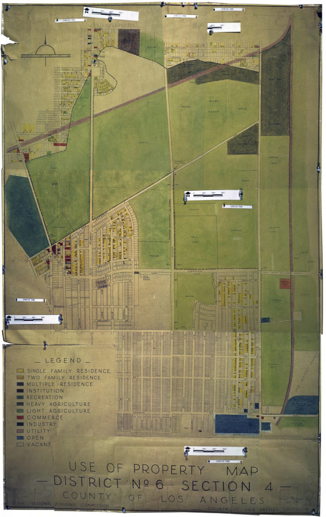
The Huntington Library’s online map collection is a treasure-trove that you can experience from your own home. My interest was piqued when I came across a map labeled “Los Cerritos Park.” As you can see there is a label Los Cerritos Park at the end of Roosevelt Drive but the park and most of Los Cerritos is off the map. The map should more properly be called Bixby Knolls. The map was made in 1939 as part of a field survey done for the Regional Planning Commission. Regional planning was started in Los Angeles County in 1922 with the establishment of the Regional Planning Commission (RPC) an organization that still exists today and is responsible for advising the Board of Supervisors on all planning matters. It is the oldest planning body in the United States. In 1927, the Los Angeles County Board of Supervisors passed an ordinance that allowed the county to regulate land use. Zoning, in the form of land use districts, had already started within the City of Los Angeles. But by the 1920’s Los Angeles was spreading out and a concerted effort to push for zoning was made by real estate interests who wanted to stabilize property values The Regional Planning Commission produced a series of maps and set about to designate land use zones, starting first in the area east of Los Angeles. Today, we still live with the repercussions of those early decisions, such as the legacy of hazardous waste sites in eastern Los Angeles County.
Some interesting history of our neighborhood is shown on this map- like the Works Project Administration’s storage sheds on the corner of California and Carson Streets, along with fields designated for crops and grazing. The fruit stand at the corner of Long Beach Blvd and San Antonio is shown. See my blog post “The Virginia County Market” August 2015 for more information about this fruit stand.
Have fun exploring the map!


Very interesting, particularly around Long Beach.